Foel Cwmcerwyn is the highest mountain in the Preseli Hills in Pembrokeshire. In fact, at 536m, it’s the highest mountain in West Wales.
As it’s uphill all the way, with an elevation gain of around 300 metres in around 2 miles, this is not the easiest walk in the Preseli Hills. But it’s totally worth it. With 360 degree views and nowhere on the horizon higher, you really do feel on top of the World here.


We can only guess at how many times we’ve walked, run and cycled it, but it must run into the hundreds. We’re still not bored of it and we’re sure you won’t be either.
There are a number of routes to the top of Foel Cwmcerwyn, but for the purposes of this post, we’ll be concentrating on the one we do most often/our favourite.
How to get to Foel Cwmcerwyn
From the North
- Take the A487 to Cardigan and stay on it towards Newport.
- Just after passing through the village of Eglwyswrw, and just after the Dyfed Shire Horse Farm, turn left on to the B4329.
- Continue through the villages of Crosswell and Brynberian and up and over the mountain and then down to Tafarn Newydd/New Inn crossroads.
- Turn left here onto the B4313 towards Rosebush/Maenclochog
- Keep on this road, passing Rosebush to your left.
- When you reach the top of the small hill you will see a house on your left (Frondeg) before the lay by on the right where you can park.
From the South or East
- Take the A40 towards Narberth.
- At the main Penblewyn Roundabout take the A478 sign-posted Cardigan.
- At the next crossroads (before Clunderwen) take a left onto the B4313 towards Maenclochog.
- Stay on this road until you read a junction at the village of Maenclochog.
- At this junction turn right and drive slowly through the village towards Rosebush
- Having left the village keep on this road until you reach the top of the hill where you will see the layby on your left where you can park
From the West
- From the A40 take the B4329 heading towards Rosebush.
- At New Inn/Tafarn Newydd crossroads turn right onto the B4313 for Rosebush/ Maenclcohog.
- Stay on this road, passing Rosebush on your left.
- When you reach the top of the hill you will see a house on your left (Frondeg),
- on the right is the lay by where you can park
Where to park for Foel Cwmcerwyn
If you’re lucky, you may be able to park in the small layby opposite the start of the lane up to the top. But, be warned, there’s only enough room for a couple of cars here. If you do manage to get a space do not block the gate to the adjacent field.
- Map ref. SN074 288 (6 figure reference)
- Grid Ref SN07429 28861
- Nearest Post Code SA66 7QR
If you can’t park there, there is a car park in Rosebush behind the Tafarn Sinc (not the pub car park itself). Turn around and take the first road which forks off to the right to Rosebush. Follow this road until you see Pant Mawr cheese on your right and then further along, the Old Post Office on your left. The car park is down the hill in front of The Old Post Office.
- Map ref. SN075 295
- Grid Ref SN07517 29534
- Nearest Post Code SA66 7QU
The walk to Foel Cwmcerwyn

If you’ve parked in the layby, cross the road taking good care. The national speed limit applies on this road and you’re on a bend and the brow of a hill here.

The route isn’t signposted but once across the road you’ll see a house called Frondeg with the path running uphill alongside it. Keeping Frondeg on your left you simply stay on this path for 2 miles and you’ll be at the summit. You can’t really go wrong. But do make sure you’ve got the right gear with you including, at the very least, a compass and this map. This is a Welsh hill after all and if that cloud comes down (and believe us, it does) you’ll be cold and wet quickly and can lose your bearings.
If you parked in the car park in Rosebush you will not need to walk back to the layby. Instead, walk up to The Old Post Office and you will see a footpath opposite. Follow this through a couple of fields and you’ll come to a stile. Hop over and turn left on to the same path as you would have been on.
First Gate

You’ll pass through 2 gates on the path and reach the first after around a mile.
The boggy bit

Around 600m on from here is where it gets wet and boggy. If you’re confident of your footing and footwear you can just head right through. If you’re less so, try skirting around to the left and pick up the track which will take you around the wettest part.
Second Gate


Once through this section the path starts to steepen to the 2nd gate, and after it is the steepest section of the walk. You’ll gain around 300 feet (or 90m) between here and the trig point which is around 600m away.
The Views from Foel Cwmcerwyn


As it’s the highest point in the Preseli Hills, 360 degree views are a given from here.
On a good day you can see as far as the Llyn Peninsula in North Wales (you know, the bit that sticks right out into the sea).
You can actually see quite a bit of the sea from here when there’s no cloud around and on a clear day as far as Ireland and Lundy.
You can also see pretty much all of Pembrokeshire and as far as the Worm’s Head at Rhossili in the Gower.
Foel Cwmcerwyn walk statistics


- Summit = 536 m
- Prominence = 344 m
- Distance = 4 miles approximately
- Walk Time = 2 hours approximately
- Total Time = At least 3 hours
- Map Ref SN094 311
Thoughts


We’ve done this walk in absolutely every weather you can imagine. Mostly in the day but sometimes in the dark (sometimes even intentionally!). We’ve been up here in August when the mist and cloud came down and it made it feel like winter. We like coming up here in the snow.
It’s not waymarked here but it doesn’t need to be. The path is easy to see and it’s obvious where you’re headed. It’s unlikely you’d lose your way here unless you’re in the middle of a cloud. Which can and does happen. So make sure you’re properly geared up even on a good day.
It’s almost always boggy in sections, even in Summer, so you will most certainly need decent waterproof boots. Forget about trainers, some parts are too wet and too deep for that.
At a minimum of 4 miles long this hill walk provides a good workout.
Facilities
There are no facilities here so be prepared. The nearby village of Maenclochog has:
- Public Conveniences
- A well stocked shop
- Petrol Stations, and
- A really good Cafe
In Rosebush there is a Public House serving lunch and dinner.
More Information
Other walks in Pembrokeshire nearby include:
- The Preseli Hills Golden Road
- Foel Eryr
- Foel Drygarn
- The Preseli Hills Crash site Walk
- The Dinas Head Walk
- The Gwaun Valley Waterfall Walk
If you are visiting Pembrokeshire now or in the near future please be aware that social distancing rules still apply in Wales. Please keep yourselves and others safe.
Disclaimer: This post may contain affiliate links. Clicking on them will result in no additional cost to you but may earn us a small commision.
12 thoughts on “Foel Cwmcerwyn”
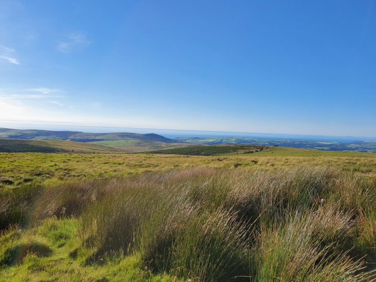
The hike up Foel Cwmcerwyn looks like a perfect outing. I love the views you get from the top – especially on a clear day. Great tip to wear boots instead of trainers for this hike because of the wet and boggy ground. Also nice to know to bring a compass – I’d never thought about getting lost in a cloud!
Thanks Becky. It is! And because there are so many ways to approach it you can make it as short or long as you want.
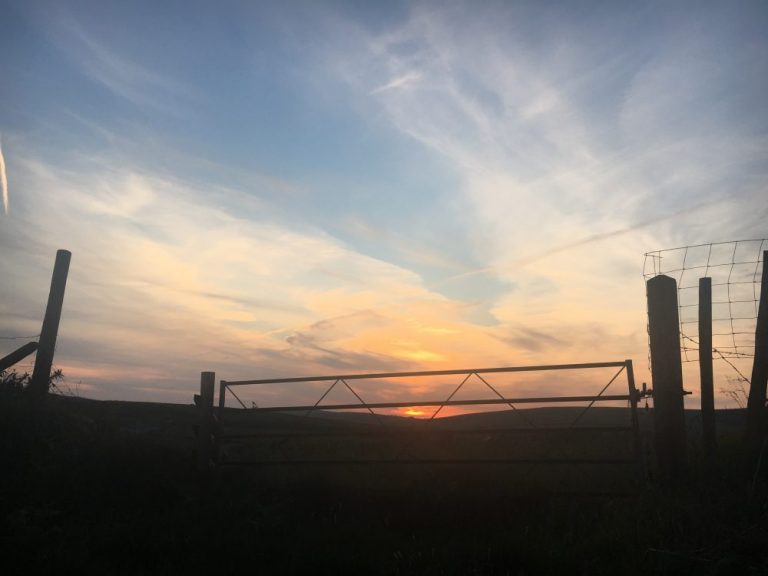
Very well-rounded post. Love seeing the shots of it from the winter too!
Thanks so much! It’s especially great in the winter 👍
We always feel like we haven’t spent enough time in Wales each time we visit the U.K. This proves it!
Thanks both 👍
Another incredible hike! I love how you’ve done this in all seasons. If you’ve gone at night, was it for stargazing? I’ve heard wales is beautiful for stargazing 🙂 can coronavirus please be over so I can finally go on my welsh trip? 🙂
Thanks so much Lannie. It is and yes all seasons, all weathers! It wasn’t actually for stargazing but that’s a great idea 👍 We just got our timings a bit wrong 😆
Love the similarities with Irish walks. First there’s the path, then off you go into the bog. Expect wet feet. 😃 another one to add to the Welsh list.
Thanks John. Yep that’s the one 😆
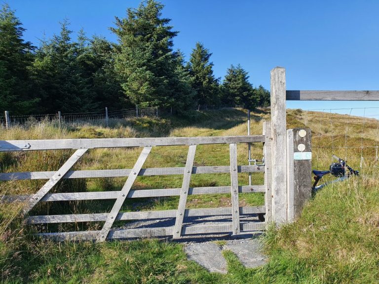
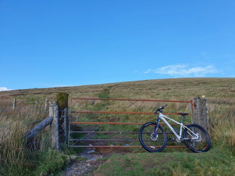
Excellent, hope to try it this year. I see the photos with the bike, is the terrain ok to ride all the way up or is it more a hike a bike?
Thanks Mark. You should be able to ride a mountain bike up to the ‘boggy bit’ and possibly a little beyond it towards the 2nd gate. It’s too steep for me after that! 😆